CHANDIGARH
TO SPITI
The last frontier. Altitude deserts, monasteries hanging off cliffsides, and roads that test every machine. This is the drive the Jimny was built for.
410 km
Distance
9 to 10 hrs
Drive time
Expert
Difficulty
Jun to Oct
Best season
4x4 only
Car
Jimny 4x4 is required for this route. No exceptions.
Spiti Valley involves river crossings, loose shale roads at 4,200m+ altitude, and sections with no traction for 2WD vehicles. We do not permit any other vehicle from our fleet on this route. Book the Jimny here.
THE ROUTE
WHAT SPITI
ACTUALLY IS
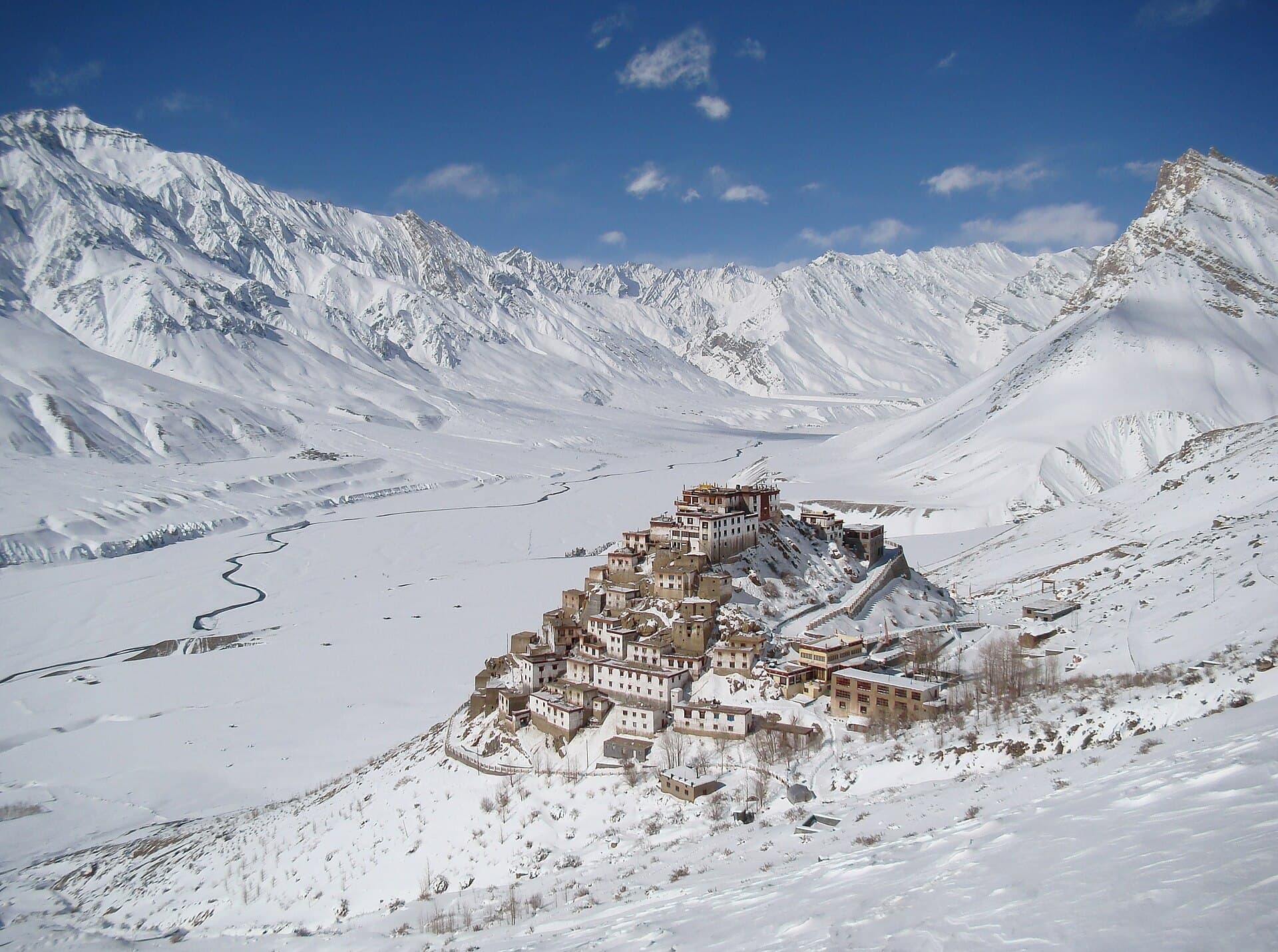
Spiti is a cold desert mountain valley in the Himalayas at an average altitude of 4,270 metres (14,009 feet). It receives less than 170mm of rainfall a year. The landscape is brown, ochre and slate, nothing like the green hills of Shimla or Manali.
The route from Chandigarh goes through Shimla, Rampur, and Kinnaur Valley before entering Spiti district at Sumdo. The approach via Kinnaur is longer but safer. The alternative via Manali over Rohtang and Kunzum is shorter, open for a much smaller window, and more technical.
Plan for 7 to 10 days minimum. A rushed Spiti trip is a wasted Spiti trip. The road distances are short in kilometres but long in time - 80km can take 4 hours. That's the nature of mountain passes at 4,500m.
WHAT YOU NEED TO PREPARE
Altitude acclimatisation: don't go from Chandigarh to Kaza (3,800m) in one day
Carry at least 20 litres of extra fuel, because petrol pumps in Spiti are unreliable
Download offline maps for the entire route before leaving Shimla
Travel insurance that covers high-altitude trekking and emergency helicopter
Warm clothing for the night, since temperatures drop below 0°C even in July
Inner Line Permit for sections near the Chinese border, which we help arrange
BOOK FOR SPITI
Jimny 4x4 Only
INCLUDED FOR SPITI
- HP & Ladakh inter-state permit
- Inner Line Permit (border zones)
- Rohtang Pass permit if needed
- Emergency contact protocol
- 24/7 WhatsApp support
STOP BY STOP
0
km
Chandigarh
Leave by 4 to 5am for Spiti. You are covering 410 km of mountain road, so every hour of morning light matters.
100
km
Shimla
Do not stop long. Aim to be in Shimla by 8 to 9am. Fuel up here before the next reliable stop at Narkanda.
145
km
Narkanda
Breakfast here. Last proper restaurant for a while. The apple orchards around Narkanda are beautiful if it's the right season.
200
km
Rampur
The Satluj gorge begins here. The road narrows dramatically and the Satluj river appears 300m below. Drive carefully.
290
km
Reckong Peo
Overnight stop recommended. Kinnaur Valley is worth a day in itself - Kalpa village with Kinner Kailash views.
340
km
Sumdo
You're entering Spiti district. The landscape becomes lunar. This is why you came.
410
km
Kaza
The capital of Spiti. Base for Key Monastery, Kibber (4,200m), Pin Valley, and Chandratal Lake.
ROAD CONDITIONS
WHAT THE ROAD IS LIKE,
SEASON BY SEASON
LATE MAY TO JUNE
The Kinnaur approach opens first and this is when it is at its most dramatic, with snow still on the shoulders above Nako. Kunzum La on the Manali side is usually still shut, so plan an out-and-back through Kinnaur rather than a loop. Water crossings past Sumdo are fed by melt and are deepest in the afternoon.
JULY AND AUGUST
Peak season and the only window where the full Kinnaur to Kunzum La loop is dependably open. It is also monsoon on the Kinnaur side, and the Nigulsari and Wangtu stretches of NH5 are among the most slide-prone roads in India. Spiti itself is a rain shadow desert and stays dry, so the weather problem is entirely on the approach.
SEPTEMBER TO MID-OCTOBER
The best time to drive Spiti. The monsoon has left Kinnaur, the water crossings have dropped, the light is extraordinary and the villages are harvesting. Kunzum La usually stays open into early October. Nights at Kaza are already below freezing, so this is a warm sleeping bag season.
LATE OCTOBER TO APRIL
We do not rent for Kaza in this window. Kunzum La closes, the Kinnaur road depends entirely on the BRO clearing slides, and the valley runs on a single lifeline that can shut for a week. Winter Spiti is a genuine expedition and it is not a self drive rental proposition.
Fuel, cash and signal
Fuel
This is the one to take seriously. Reckong Peo and Kaza are the two dependable pumps and they are roughly 200 kilometres apart with nothing usable in between. Fill completely at Peo, and fill again at Kaza before Pin Valley or Chandratal. Carrying a spare jerry can is normal practice here rather than paranoia.
Cash and ATMs
Reckong Peo has working ATMs. Kaza has a couple and they are unreliable, particularly at the end of a long weekend. Carry enough cash for the whole valley, because homestays in Langza, Komic and Kibber are cash only and there is no argument to be had about it.
Mobile network
BSNL is the only network that works reliably past Pooh, and even that is intermittent. Jio reaches Kaza and Tabo on a good day. Between Nako and Sumdo assume nothing. Download offline maps before Reckong Peo, tell someone your plan, and treat the satellite communicator we lend as the actual communication tool.
Weather to watch
Slides on the Kinnaur side after rain, which is the main risk on the approach. Inside Spiti it is altitude and cold rather than precipitation. Afternoon meltwater raises the crossings past Sumdo, so cross them in the morning. Kunzum La can take unseasonal snow in September.
How long it really takes
Nine to ten hours from Chandigarh to Reckong Peo, and that is a full day. Peo to Kaza is another seven to eight, and those figures assume no clearing operation on the Kinnaur side, which is an optimistic assumption in July.
Anyone planning Chandigarh to Kaza in two days is planning to arrive unwell. The Kinnaur approach exists as the sensible route precisely because it gains altitude gradually: Sarahan or Sangla, then Nako, then Tabo, then Kaza. Four nights to reach Kaza is not slow, it is correct.
Inside the valley, distances are short and times are long. Kaza to Chandratal is 90 kilometres and can take five hours. Kibber, Langza and Komic are all under 20 kilometres from Kaza and each takes an hour. Budget by hours, never by distance.
Where the drive gets hard
Nigulsari and Wangtu on NH5
The most notorious slide zones in Kinnaur. Loose rock above the road, active cutting, and long waits when a crew is working. Do not stop under the cut faces for photographs, which is exactly where people do stop.
The Khab to Nako climb
Switchbacks on a narrow ledge with a very long drop and no barrier for most of it. The surface is decent but the width is not. Give buses the whole road and reverse to a wider point if you meet one mid-corner.
Sumdo to Tabo water crossings
This is where tarmac gives up and 4x4 stops being optional. Glacier-fed crossings that are ankle deep at eight in the morning and knee deep by three. Walk them if you are unsure, cross in low ratio, and cross early in the day.
Kunzum La and the Chandratal spur
At 4,590 metres, snow-covered edges into September and a surface of loose shale on the descent toward Batal. The Chandratal spur is 14 kilometres of the worst road on the trip. Low ratio, patience, and not after dark.
The Chicham bridge and Kibber road
Narrow, exposed and at over 4,000 metres, which affects both the car and you. The bridge itself is fine and the approach is where people misjudge width. This is a slow, deliberate stretch rather than a difficult one.
LOOKING FOR RATES INSTEAD
This page is the drive. The rental sits next door.
Day rates for every car cleared for Spiti Valley, the kilometre arithmetic for this exact distance, what the deposit is and how the permits work are all on the rental page rather than here.
Car rental Chandigarh to Spiti Valley →FAQ
SPITI VALLEY
QUESTIONS
How far is Spiti Valley from Chandigarh?
Kaza, the main town in Spiti, is about 410 km from Chandigarh via Shimla, Rampur and Kinnaur. The distance sounds modest. The driving does not. Budget 9 to 10 hours of wheel time spread over two days, because attempting it in one sitting means arriving at 3,800 metres exhausted, which is exactly how altitude sickness starts.
Do I need a 4x4 to drive to Spiti Valley?
For the full circuit, yes. The Kinnaur approach as far as Reckong Peo is tarmac and a 2WD car copes with it. Past Sumdo the surface turns to loose shale, there are water crossings fed by glacier melt that deepen through the afternoon, and the climb to Kibber and Langza sits above 4,200 metres. We only release the Jimny 4x4 for this route, and that is a condition of the rental rather than an upsell.
When is Spiti Valley open for self drive?
The Kinnaur route is usually drivable from late May to October, and that is the window we rent for. The Manali side, over Kunzum La, opens later and closes earlier, roughly late June to early October, because the pass holds snow. Winter access to Kaza does happen via Kinnaur, but it depends entirely on the BRO clearing slides and is not something we hand keys out for.
Do I need an Inner Line Permit for Spiti?
Indian nationals do not need one for Kaza or the main Kinnaur to Spiti road. You do need an Inner Line Permit for the stretch between Jangi and Sumdo near the Tibet border, and for Pin Valley beyond a point. Permits are issued at the SDM offices in Reckong Peo or Kaza and take under an hour with a photo and ID. Foreign nationals need a Protected Area Permit and cannot travel solo, so a group of at least two is required.
Where do I refuel between Shimla and Kaza?
Fuel up properly at Rampur, then again at Reckong Peo. After that the only pump before Kaza is at Powari, and it runs dry more often than anyone admits. Kaza has one pump, which is the highest retail outlet in the country and frequently has a queue. Carry 20 litres in a jerry can. Nobody who has driven Spiti twice does it without one.
How many days do I need for a Chandigarh to Spiti trip?
Seven days is the honest minimum for the Kinnaur loop out and back. Nine to ten lets you add Chandratal, Pin Valley and a rest day at altitude without racing. Anything under six days turns the trip into a driving marathon where you see the road and very little else, and it raises the altitude risk sharply because you skip acclimatisation.
Is there mobile network in Spiti Valley?
Patchy, and only on some networks. BSNL and Jio hold up in Kaza and around Reckong Peo. Airtel is weak past Nako. Between Nako and Kaza expect long dead stretches. Download offline maps before Shimla, tell someone your route, and treat any plan that depends on live connectivity as a plan that will fail.
How bad is altitude sickness on this route?
Real enough to change your itinerary for. Kaza sits at 3,800 metres and Kibber and Komic go past 4,200. The Kinnaur approach helps because you gain height gradually over two days, which is precisely why we recommend it over the Manali side for a first trip. Sleep low, climb high during the day, drink far more water than feels necessary, and give yourself a slow first day in Kaza. If a headache comes with breathlessness or vomiting, descend. Any medication question is one for your doctor before you leave, not for us.
Can I drive the Spiti circuit one way via Manali?
Yes, and it is the better trip if the timing works. Enter through Kinnaur, exit over Kunzum La to Manali, and you gain height slowly and never repeat a road. It only works from roughly late June to early October when Kunzum is open, and it needs both permits sorted in advance. Tell us at booking so we plan the return leg and the drop properly.
SPITI IS WAITING
7 to 10 days. One Jimny. The most dramatic landscape in India. Book early, because availability is limited in peak season.